

Loading panorama viewer ...
Configuring ...
© 2007 Wim Gombeer, All Rights Reserved.
Caption
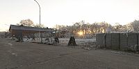
Reigersvliet were once part of the military installations in Leopoldsburg. This part of the military field was given by Defence to the municipality for development of it.
Equipment
Nikon D200 + 10,5mm + Seitz VRdrive + PTgui + Cubic converter + Photoshop
 Tap or click the zoom icon in the bottom right corner of the picture to switch between in-page and fullscreen view