
Forest
Mount Maxwell Provincial Park, Salt Spring Island, British Columbia, Canada
December 21, 2004, 11am PST

Loading panorama viewer ...
Configuring ...
© 2004 Uri Cogan, All Rights Reserved.
Caption
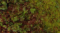
This is an old-growth Douglas Fir forest. A peaceful sanctuary with breath-taking views from the peak."Stop the words now. Open the window in the center of your chest, and let the spirits fly in and out." --Rumi
Come visit my web site and gallery
Location
USA-Canada / Canada-British Columbia
Lat: 48° 48' 1" N
Long: 124° 31' 50" W
Elevation: 580 ft.
Precision is: High. Pinpoints the exact spot.
Equipment
Nikon D70, PTMac, Xblend, Cubic Converter, Dual processor Mac G4.
 Tap or click the zoom icon in the bottom right corner of the picture to switch between in-page and fullscreen view