
Harpa Center / Krýsuvík Geothermal Area
Reykjavik / Krýsuvík, Iceland
21st & 22nd June, 2013

Loading panorama viewer ...
Configuring ...
© 2013 Brian Richards, All Rights Reserved.
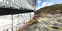
Caption
A composite of the Harpa concert hall and conference centre in Reykjavík and the Krýsuvík geothermal area on the Reykjanes peninsula in Iceland.Harpa was designed by the Danish firm Henning Larsen Architects in co-operation with Danish-Icelandic artist Olafur Eliasson. The structure consists of a steel framework clad with geometric shaped glass panels of different colours - http://www.olafureliasson.net/works.html
The building was originally part of a redevelopment of the Austurhöfn area dubbed World Trade Center Reykjavík, which was partially abandoned when the financial crisis took hold. The development was intended to include a 400-room hotel, luxury apartments, retail units, restaurants, a car park and the new headquarters of Icelandic bank Landsbanki.
The completion of the structure was uncertain until the government decided in 2008 to fully fund the rest of the construction costs for the half-built concert hall. The building was given its name on the Day of Icelandic Music on 11 December 2009, prior to which it was called The Reykjavík Concert Hall and Conference Centre (Icelandic: Tónlistar- og ráðstefnuhúsið í Reykjavík). The building is the first purpose-built concert hall in Reykjavík. It houses the Iceland Symphony Orchestra and The Icelandic Opera.
The geothermal area Krýsuvík is situated on the Reykjanes peninsula in Iceland. It is in the south of Reykjanes in the middle of the fissure zone on the Mid-Atlantic Ridge which traverses Iceland. Krýsuvík consists of several geothermal fields, such as Seltún. Here solfataras, fumaroles, mud pots and hot springs have formed, the soil is coloured bright yellow, red, and green hues. Sulphur deposits were mined in 1722 - 1728 and in the 19th century. German scientist Robert Bunsen visited the site in 1845 and, based on research there, proposed a hypothesis on formation of sulphuric acid in nature. Near the geothermal fields are several maars - craters created by the explosions of overheated groundwater. The unusual green-blue Grænavatn lake has formed in one of these maars. Test boreholes were made here in the early 1970s, some of the boreholes have turned into irregular, artificial geysers, one of which exploded in 1999, leaving a crater. [Wikipedia]
PhotoWebLab http://photoweblab.zenfolio.com
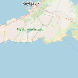
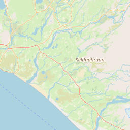
Location
Lat: 64° 9' 1.42" N
Long: 22° 56' 58.37" W
Elevation: 88 ft
Precision is: High. Pinpoints the exact spot.


Equipment
Nikon D600, Sigma 15mm f/2.8 fisheye lens
 Tap or click the zoom icon in the bottom right corner of the picture to switch between in-page and fullscreen view