

Loading panorama viewer ...
Configuring ...
© 2010 Piotr Popik, All Rights Reserved.
Caption
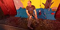
While electronic media tends to displace live art, THIS wonderful Open Theatre Teatr Otwarty is very alive for many of us. It has existed since 1999 and has already been performed more than 500 times. What is unusual is that the actors not only act, but create the screenplays, costumes and music all by themselves. And all this is for the most demanding audience: the children that usually take an active part during drama performance. That day Teatr Otwarty played "TRĄBA SŁONIA SALOMONA" drama at an old movie theater Wrzos, Zamoyskiego 50 street. Wrzos is one of the last art-house movie theaters in Kraków that survived the invasion of the giant multiplexe theaters...
Equipment
The panorama was taken with Peleng MC f 3.5/8 mm lens (set at f 5.6, ~ 1.5 m) on Canon EOS 20D camera, (set at: 1/4s), ISO 800). The panorama was stitched with 6 images (5 around plus zenith) using Professor’s Helmut Dersch Panorama Tools (PTGui 4.1 graphical interface). Autopano and Enblend, as well as Gimp's ability to create Text Circle Logo were all of great help. I used 8-bit source images.
Equirectangular image was created with registered version 1.6.2 of Pano2QTVR Pro.
 Tap or click the zoom icon in the bottom right corner of the picture to switch between in-page and fullscreen view