

Loading panorama viewer ...
Configuring ...
© 2011 Piotr Popik, All Rights Reserved.
Caption
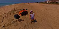
One week of holidays with baby Marianna (who can be found on majority of my other contributions), is always a fun. At this place, where the weather is always great, it could not be better. Maybe except... the water could be warmer: please note so little people were swimming. We had a wonderful time, not to mention celebrating the 25th anniversary of the marriage with my wife!
Equipment
The panorama was taken with a Peleng MC f 3.5/8 mm lens (set at f/16, ~ 1.5 m) on a Canon EOS 20D camera (set at: 1/1500), ISO 200).
Lots of sun!The panorama was stitched with 5 images (4 around plus zenith, added later) using Professor Helmut Dersch's Panorama Tools (PTGui 4.1 graphical interface). Autopano and Enblend, as well as GIMP's ability to create the text circle logo were all of great help. I used 16-bit source images.
The equirectangular image was created with registered version 1.6.2 of Pano2QTVR Pro.
 Tap or click the zoom icon in the bottom right corner of the picture to switch between in-page and fullscreen view