

Loading panorama viewer ...
Configuring ...
© 2006 Carsten T. Rees, All Rights Reserved.
Caption
The Schauinsland mountain (1284 m) lies within the borders of Freiburg. Much of the wealth of Freiburg in medieval times derived from the silver mining deep within the Schauinsland. Nowadays the Schauinsland is a tourist attraction.
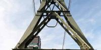
In 1930 the Schauinslandbahn, a gondola lift to the top of the Schauinsland, was opened. It still is the longest German gondola lift, spanning a distance of 3600 m and a difference in height of some 746 m. The valley terminal is located at app. 480 m above sea level – the terminal on the mountain is located at app. 1230 m above sea level.
The Schauinslandbahn is part of the public transportation of the City of Freiburg. From the center of the city a tram and a subsequent bus line will take you to the valley terminal in no more than 21 minutes. The ride on the gondola lift will take another 15 minutes. Since there are 37 cabins available, one never has to wait very long for the next ride. The Schauinslandbahn can take a maximum of 700 persons per hour to the top of the mountain.
So within some 40 minutes you can escape the crowded city and the hazy Rhine valley and you will find yourself on top of a Black Forest mountain. There you can overlook both the city and the Rhine valley. On clear days you can see the Vosges mountains in France and the Alps in Switzerland. And this is exactly, what the name "Schauinsland" implies: The English translation of the name is "Look into the land". So in my panorama the young lady to the left is taking the name "Schauinsland" rather literal.
Location
Lat: 47° 54' 36.5" N
Long: 7° 53' 27.03" E
Elevation: 1230m (corrected)
Precision is: High. Pinpoints the exact spot.
Equipment
Canon EOS 5D, Sigma 12-24 mm, Manfrotto 303SPH + 338, Realviz Stitcher 5.1
 Tap or click the zoom icon in the bottom right corner of the picture to switch between in-page and fullscreen view