

Loading panorama viewer ...
Configuring ...
© 2006 Yaniv Sirton, All Rights Reserved.
Caption
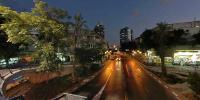
In July, 2003, UNESCO, the United Nations Educational, Scientific and Cultural Organization, proclaimed "The White City", the unique urban and historical fabric of Tel Aviv-Jaffa, as a World Cultural Heritage site. By this proclamation, the world recognized the special architectural qualities of the buildings, streets, squares and avenues of Tel Aviv.Zina Dizengoff Circle, named after the wife of the first mayor of the city, was the first square in the city given architectural lines.
In 1934, architect Genia Averbuch won a competition to design the square. Averbuch designed the houses around the square in form of a circle. Long balconies surround the length of all the buildings – the balcony walls serve as envelopes of shade. The horizontal lines of the balconies were determined by the narrow openings between the banister and the banisters of the upper balcony and by the narrow ventilation slot.
There used to be a round pool of water in the square, with a fountain in its center. Around the pool, was a ring of grass, a gravel path and another ring of grass, after which came shade trees and paths that linked the nearby streets. In the original plan, the square was to be lifted to provide parking for buses and taxis. Different traffic problems delayed this idea of elevation until 1978. As a result of heavy traffic, it was decided to isolate the vehicles from the pedestrians by raising the square. The old square became the symbol of the city, a center for pastimes and encounters.
In 1986 a fountain created by Yaacov Agam was built and dedicated to the friendship between the cities of Tel Aviv and Frankfurt The fountain entitled the Fire and Water sculpture is located on a raised roundabout that is painted in a bright, rainbow design.
Nowadays, a new plan was made to destroy the square and rebuild it with the old 1934 design.
http://www.white-city.co.il/images/357_28_4_m.jpg
http://www.white-city.co.il/english/index.htm
Equipment
Nikon D70, Sigma 8mm
 Tap or click the zoom icon in the bottom right corner of the picture to switch between in-page and fullscreen view