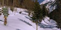
Snow - My Personal Border
Close to Valepp, Spitzingsee Area, Bavaria, Germany
March 19, 2006 - 13:45 UTC (14:45 local time)
© 2006 Carl von Einem, All Rights Reserved.
For this particular event, I wanted to show one of the interesting borders between Germany and Austria: a so-called "green" border. No guards or fence, just an open space. In the summertime, you can cross a virtual borderline between the two countries during a hike without even noticing it. This time, however, the snow represented a physical border to me and prevented me from actually reaching this place.
This March we had very unseasonable loads of snow and this is what actually happened: on a bright Sunday morning I went to Spitzingsee by train and bus. Spitzingsee is a little village alongside a beautiful lake with the same name and is located in the Bavarian Alps, close to the Austrian border.
As part of my gear, I carried a big tripod for my medium format camera. So there was no way to take along my touring skis as well. After a two hours walk on a little snow-covered road, I realized that the next part of my hike would be on a path that had only been used by two touring skiers in the last days, and this track would actually not carry my weight. I was in deep ...snow.
For another three-quarters of an hour I advanced slowly, every now and then sinking into the snow with my climbing boots. My GPS indicated that I'd have to spend the night somewhere in the snow if I continued trying to reach this "green" border.
When I came to a guidepost, one of the signs indicated a route to the Sonnwendjoch - a mountain with the German word for solstice (Sonnwend) as part of its name. I decided that this was my personal border for the day and it is also a perfect place for a panorama. Enjoy!
Lat: 47° 36' 36.2" N
Long: 11° 53' 49.7" E
Elevation: 947 m
Precision is: High. Pinpoints the exact spot.
- Mamiya 7II (6x7 format rangefinder camera), 43 mm lens (20 mm equivalent)
- 2 rows of 8 images on Kodak Portra 400 VC
- scanned with Hasselblad Flextight
- stitched with PTMac/enblend64, post-processing with Photoshop, CubicConverter and Landis' VRPrep script


 Tap or click the zoom icon in the bottom right corner of the picture to switch between in-page and fullscreen view