
Cape Spear in 2024 - The most easterly point of land in North America (excluding Greenland)
Cape Spear, Newfoundland and Labrador, Canada
June 8 2024 - 18:00 UTC

© 2024 Kenneth A. Butt, All Rights Reserved.
The area has been designated a Canadian National Historic Site. Naturally, the cape has hosted many lighthouses; the first from 1836. Now restored to circa 1939, the original lighthouse (not visible in this pano) is open for public viewing. The concrete lighthouse that is visible on the crest was built in 1955 as its replacement.
It takes about 20 minutes to drive to Cape Spear from St. John's; NL's capital city. The entrance to St. John's harbour can be seen as a dip in the land just to the right of the red Cape Spear sign. Next to this is Signal Hill with the Cabot Tower at its top.
USA-Canada / Canada-Newfoundland and Labrador
Lat: 47° 31' 26.826" N
Long: 53° 38' 16.085" W
Precision is: High. Pinpoints the exact spot.
Pentax K-5, 10mm fisheye, Nodal Ninja MkII w Travel pole, rotator and tripod, PTGUI, Pano2VR and PS 2024
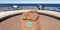
This is a reshoot of the same scene from the Limits Event in 2011. New visitors will notice significant enhancements to the area; improved walking trails, better signage, seating areas and a cafe to name a few.
 Tap or click the zoom icon in the bottom right corner of the picture to switch between in-page and fullscreen view