© 2008 Tom! Striewisch, All Rights Reserved.
It was photographed during a trip to the lighthouse "Roter Sand." This building is located in the North Sea in the mouth of the river Weser, half of the way from Bremerhaven to Helgoland. It claims to be the first offshore building in the world.
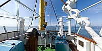
You can only get there by ship, a boat trip is the only way to visit the ligthouse. From time to time during the summer an old museal tug, the "Goliath" drives the 40 sea miles to this location. It carries visitors and guests.
The visitors (as me) will spend some time on the lighthouse and then drive back with the Goliath the same day. The guests will stay overnight on the Roter Sand. The tug will return the next day (if the weather is collaborating, if not; "Good luck!" ;-) ) to take the guests back to the harbor of Bremerhaven, its home port.
"Roter Sand" isn't any longer in duty, it was replaced in 1964 by a new Lighthouse "Alte Weser." Roter Sand is now kept alive by a group of people (Friends and Supporters, "Förderverein" in the German language).
The 4 hours boat trip to this lighthouse happened on a very sunny and calm summer day. No one got seasick. I stayed for hours on the "Peildeck", the highest part of the ship, watching the ships that drove to and from Bremerhaven.
The visit on Roter Sand was very interesting, in the near future (Feb. 2009) I will put up one or two panorams from inside the Lighthouse.
But the best all in all was the boat trip. The way back to Bremerhaven took nearly 4 hours and we arrived in the harbor by the light of the full moon.
A wonderful day out!
Lat: 53° 45' 33" N
Long: 8° 11' 52" E
Elevation: 6
Precision is: Medium. Nearby, but not to the last decimal.
Nikon 10.5mm
Nodalpointadapter "Rohrschelle" http://www.langebilder.de/rohrschelle.htm
Monopod
Lightroom
Photoshop CS 3
Sphere to Cubic (Superrune)
PTGui
Pano2VR


 Tap or click the zoom icon in the bottom right corner of the picture to switch between in-page and fullscreen view