Micro Panorama Thumbnail for Social Sharing Sites

International Year of Forests

(January 1st, 2011 - December 31st, 2013)

Colin Ewington

Black Spur

Colin Ewington

River View

Victoria, Australia

December 30, 2011

Loading panorama viewer ...
Configuring ...

© 2011 Colin Ewington, All Rights Reserved.

Help
Caption
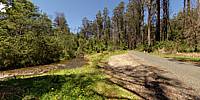
There is a road that leads from Warburton to Marysville in Victoria called the Acheron Way. For the best part of the journey it is a dirt road with lots of bends. When it nears the Marysville end it runs close to the Acheron River.
Location

Australia - New Zealand / Australia

Lat: 38° 36' 8.76" S
Long: 145° 41' 42.62" E

→ maps.google.com [EXT]

Precision is: High. Pinpoints the exact spot.
30 km
30 mi
Leaflet | Map data © OpenStreetMap contributors
Equipment
Using a Manfrotto 360 degree tripod head, I took four shots with a Canon 8-15mm f4 fisheye lens coupled to a Canon EOS 7D. The angle of the camera was around +30 degrees, which gave me a hole at the nadir but I didn’t need to work on the zenith because PTGui Pro took care of that for me. I then processed the equirectangular image in CubicConverter. I converted the file to a Cubic QuickTime Movie and then exported the bottom face to Photoshop CS5 where I fixed the Nadir using Content Aware. Back in CubicConverter I replaced the fixed bottom face and converted the resulting QuickTime Movie to a equirectangular image.

PLEASE RESPECT THE ARTIST’S WORK. All images are copyright by the individual photographers, unless stated otherwise. Use in any way other than viewing on this web site is prohibited unless permission is obtained from the individual photographer. If you're interested in using a panorama, be it for non-profit or commercial purposes, please contact the individual photographer. The WWP can neither negotiate for, nor speak on behalf of its participants. The overall site is copyright by the World Wide Panorama Foundation, a California Public Benefit Corporation. Webdesign © by Martin Geier www.geiervisuell.com