© 2013 Marcin Mróz, All Rights Reserved.
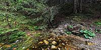
Jest to największe wywierzysko w całych polskich Tatrach. Według pomiarów z 1900 r. jego wydajność wynosiła 500 l/s, obecnie jest mniejsza i bardzo zmienna. Przy wysokich stanach wód wynosi nawet 6000 l/s, a przy niskich spada do 130–200 l/s. Otwór tego wywierzyska znajduje się na linii wielkiego pęknięcia tektonicznego, oprócz głównego otworu w pobliżu znajdują się jeszcze dwa mniejsze źródła. Średnia temperatura wody wynosi 4,5–5,2 °C, co wskazuje na to, że podziemne przepływy zasilające to źródło znajdują się niezbyt głęboko.
Barwienia wód wykazały, że wywierzysko to zasilane jest wodami z doliny Pańszczycy, które przepływają podziemnymi kanałami poniżej koryta Suchej Wody Gąsienicowej. To jest przyczyną zanikania wód Pańszczyckiego Potoku na niektórych odcinkach. W wodach wywierzyska stwierdzono występowanie skorupiaka studniczka tatrzańskiego.
English (from Google Translate):
Olczyska Spring - spring located on Olczyska Glade Valley Olczyska in the Western Tatras, at an altitude of 1,063 m above sea level at the foot of Skupniowego Upłazu the western side of the vast hall.
It is the largest spring in the whole Polish Tatra Mountains. According to the measurements of 1900, its yield was 500 l/s, is now smaller and highly variable. At high water levels of up to 6000 l/s, while at low drops to 130-200 l/s. The opening of this spring is on the line of the great tectonic cracks, apart from the main hole nearby are two more smaller sources. Average water temperature is 4,5-5,2°C, which indicates that the groundwater flow is the source of power are not very deep .
Water staining showed that spring is fed by the waters of the valley Pańszczyca that flow underground channels below the trough Dry Water Gąsienicowa. This is the cause of the disappearance of water Pańszczyckiego Stream on certain sections. In the waters of the occurrence of crustacean wywierzyska studniczka Tatra.


 Tap or click the zoom icon in the bottom right corner of the picture to switch between in-page and fullscreen view