

Loading panorama viewer ...
Configuring ...
© 2008 Hans Hagen, All Rights Reserved.
Caption
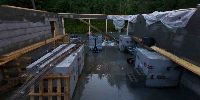
I am building my new design studio these days. The first step is over and the next is about to take place. It will be a 60 sqm.
Location
Lat: 59° 29' 13" N
Long: 8° 37' 56" E
Elevation: 150 meter
Precision is: Unknown / Undeclared.
Equipment
Canon 20d, Sigma 8mm, PTMac, CubicConverter, Photoshop CS3.
 Tap or click the zoom icon in the bottom right corner of the picture to switch between in-page and fullscreen view