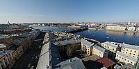
Bird's eye view of Tuchkov bridge
Vasilievsky Island, Saint Petersburg, Russian Federation
April 12, 2010 - 12:47 GMT+0 (16:47 local time)
© 2024 Andrew Varlamov, All Rights Reserved.
I am an islander by birth, because I was born and lived 14 years on Vasilievsky Island. The house where we lived in a communal apartment stood and still stands on the corner of Sredny Prospekt and Admiral Makarov Embankment. I saw the belfry and the dome of the church every day. And only 36 years later (in 2010) did it become possible to climb to the height of the belfry, thanks to the scaffolding. That day the weather was sunny, and ice floes from Lake Ladoga were floating along the Malaya Neva river.
Tuchkov bridge connects Vasilievsky Island and Petrogradsky Island. Its name, according to some sources, originates from the neighbouring lumber-yards, which belonged to merchant Avraam Tuchkov, who sponsored the construction of the bridge; the other sources refer to engineer A.V. Tuchkov, who built the bridge in the 18th century.
Earlier, as of the end of the 1750s, a boat bridge with pilework across a shallow channel was launched on this site, in the cross section of Maly Avenue of Vasilievsky Island.
In 1833-35, the bridge was replaced with a wooden multi-span pile bridge of trestle structure, with a double-wing opening central span. In 1839 the dike of Tuchkov Bridge was covered with artificial asphalt, the first in Russia.
In 1948, wooden spans were replaced with metal.
In 1962-65, Tuchkov Bridge was altered to form a three-span bridge (engineers V.V. Demchenko, B.B. Levin, architects P.A. Areshev, L.A. Noskov). The central swing span of the bridge is made of metal and has a double-winged bascule structure; the side spans are made of prestressed concrete and make use of cantilever suspension with curved bottom chords. During the construction period, a temporary bridge was built for tram and pedestrian traffic. On October 30, 1965, the bridge was tested using tanks T-54 (I remember well those days when tanks stood on the neighboring streets). On November 6, the bridge was opened for traffic.
The granite-faced bridge footing is made of reinforced concrete. The bridge is 226.2 meters long and 36 meters wide.
My first short virtual tour was made from 4 panoramas taken from corners of belfry and it was published on Google Maps. I regret that at that time I was not familiar with the "Flying Willy" technology.
Lat: 59° 56' 47.156" N
Long: 30° 17' 9.018" E
Precision is: Medium. Nearby, but not to the last decimal.
Camera: Pentax K20D ; Lens: smc PENTAX-DA Fish-Eye 1:3.5-4.5 10-17mm ED (IF) ; Panohead: Nodal Ninja 5 ; Tripod: Manfrotto 349 Column Clamp + Manfrotto 556B Levelling Centre Column ; Software: PTGui Pro 8.3.7 by New House Internet Services B.V. (dated by March 11, 2010), Pano2QTVR Pro Flash version 1.6.6 by Thomas Rauscher


 Tap or click the zoom icon in the bottom right corner of the picture to switch between in-page and fullscreen view