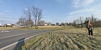

Snickersville Turnpike in Virginia Horse Country
Between Philomont and Middleburg, Virginia, USA
6:00 PM EST

© 2004 Skip Steuart, All Rights Reserved.
Scenes like this can be found 50 miles west of Washington DC. Northern Virginia is on of the fastest growing regions in the US, but you can still find old roads lined with horse farms, stonewalls, and pre civil war houses. Many of the roads are based on Native American Indian trails. A history of this road can be found at: http://www.snickersvilleturnpike.org/byway.htm
Also in the picture: Jackie Randolph, Rose Hughes, Bill Jaseph
Lat: 39° 0' 0" N
Long: 78° 40' 0" W
Precision is: Medium. Nearby, but not to the last decimal.
Canon Rebel/Sigma 8mm/Kaidan head/Panotools & Photoshop CS
 Tap or click the zoom icon in the bottom right corner of the picture to switch between in-page and fullscreen view